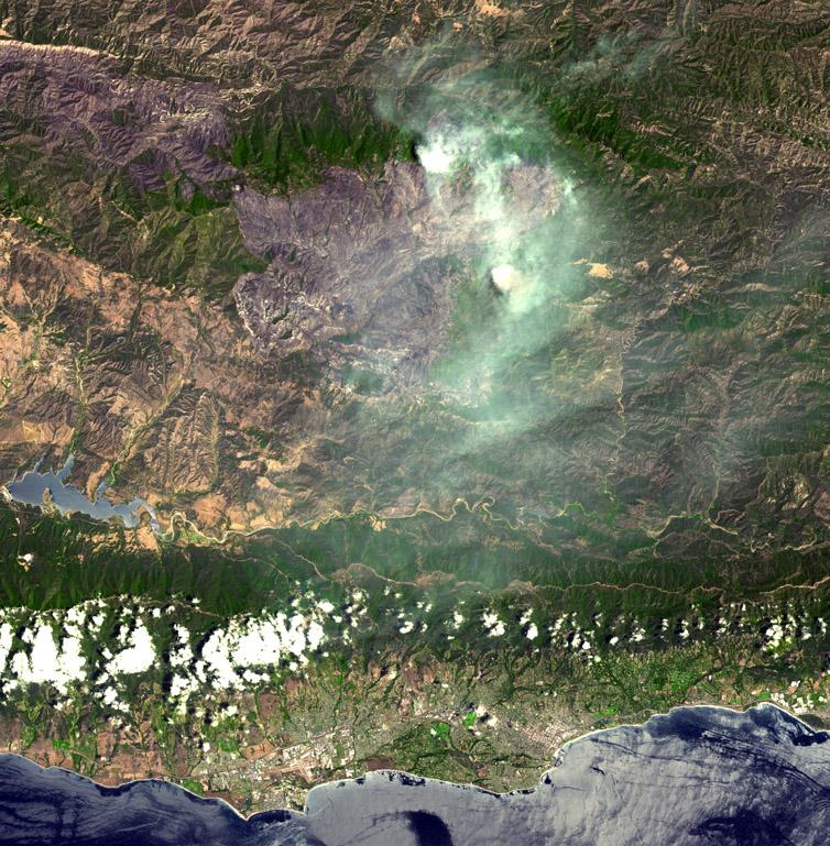
On August 7, 2007, the Zaca fire continued to burn in the Los Padres National Forest near Santa Barbara, California. The fire started more than a month ago, on July 4, and has burned 69,800 acres. The fire remains in steep, rocky terrain with poor access. The continued poor access makes containment difficult in the wilderness area on the eastern flank. So far only one outbuilding has been destroyed; but over 450 homes are currently threatened. Over 2300 fire personnel, aided by four air tankers and 15 helicopters, are working to contain this massive fire. Full containment is expected on September 1.
The image covers 45.2 x 46.1 km, and is centered near 34.6 degrees north latitude, 119.7 degrees west longitude.
With its 14 spectral bands from the visible to the thermal infrared wavelength region, and its high spatial resolution of 15 to 90 meters (about 50 to 300 feet), ASTER images Earth to map and monitor the changing surface of our planet.
ASTER is one of five Earth-observing instruments launched December 18, 1999, on NASA's Terra spacecraft. The instrument was built by Japan's Ministry of Economy, Trade and Industry. A joint U.S./Japan science team is responsible for validation and calibration of the instrument and the data products.
The broad spectral coverage and high spectral resolution of ASTER provides scientists in numerous disciplines with critical information for surface mapping, and monitoring of dynamic conditions and temporal change. Example applications are: monitoring glacial advances and retreats; monitoring potentially active volcanoes; identifying crop stress; determining cloud morphology and physical properties; wetlands evaluation; thermal pollution monitoring; coral reef degradation; surface temperature mapping of soils and geology; and measuring surface heat balance.
The U.S. science team is located at NASA's Jet Propulsion Laboratory, Pasadena, Calif. The Terra mission is part of NASA's Science Mission Directorate.
Size: 45.2 by 46.1 kilometers (27.9 by 28.5 miles)
Location: 34.6 degrees North latitude, 119.7 degrees West longitude
Orientation: North at top
Image Data: ASTER Bands 3, 2, and 1
Original Data Resolution: ASTER 15 meters (49.2 feet)
 Planetary Data System


