During the year spent waiting to achieve the planned circular, polar Mapping Orbit, the Mars Global Surveyor (MGS) Mars Orbiter Camera (MOC) took about 1170 pictures that had resolutions in the 2 to 20 meters (7-66 feet) per pixel range. These pictures were obtained between September 1997 and September 1998, and are now archived with NASA and available to the public at NASAPDS--http://ida.wr.usgs.gov/. Although these pictures were generally a vast improvement in spatial resolution compared to the previous images from Viking and Mariner, the latest pictures from MOC--taken this month (April 1999) from the proper Mapping Orbit--demonstrate the power of the MOC when in focus and operating at the correct altitude (~380 km or 235 miles).
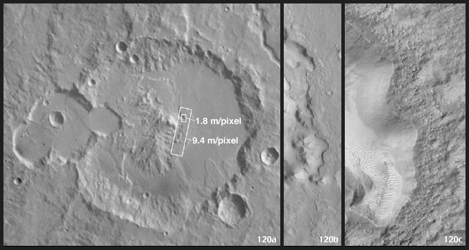
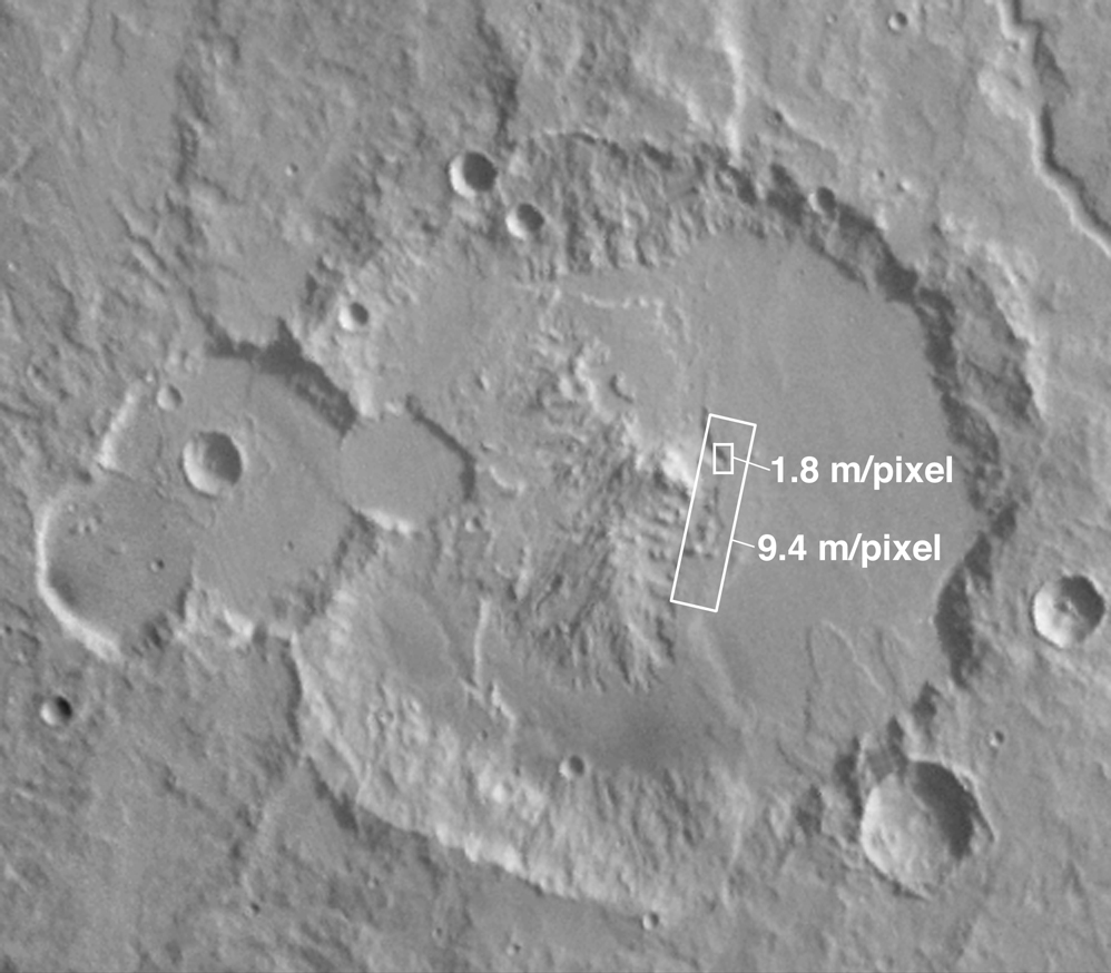
The Viking Orbiter picture on the left, above, shows the 83 kilometers-(52 miles)-wide crater, Escalante. Located on the martian equator at 245°W longitude, a portion of this crater's floor was seen by MOC before the mapping mission began, at a resolution of 9.4 meters (31 feet) per pixel as shown in the middle image. The new picture--on the right--peers down into one of the pits seen in the earlier MOC image--only now it is viewed at 1.8 meters (6 feet) per pixel.
The new high resolution image (right) covers an area only 1.5 kilometers (0.9 miles) wide and shows that the crater floor--which appears relatively smooth in the context view on the left--is actually quite rough at the scale that a human being would notice if trying to hike around in this landscape. The latest picture also shows small, bright windblown dunes that were not visible in the earlier MOC image.
MOC2-120a is a mosaic of Viking Orbiter images 381s62 and 379s47, and MOC2-120b is a subframe of MGS MOC image SPO-2-382/04. The large white box shows the location of MOC2-120b, and the small white box shows the location of MOC2-120c. In MOC2-120a and MOC2-120b, illumination is from the right/upper right, in MOC2-120c it is from the left.
Malin Space Science Systems and the California Institute of Technology built the MOC using spare hardware from the Mars Observer mission. MSSS operates the camera from its facilities in San Diego, CA. The Jet Propulsion Laboratory's Mars Surveyor Operations Project operates the Mars Global Surveyor spacecraft with its industrial partner, Lockheed Martin Astronautics, from facilities in Pasadena, CA and Denver, CO.
