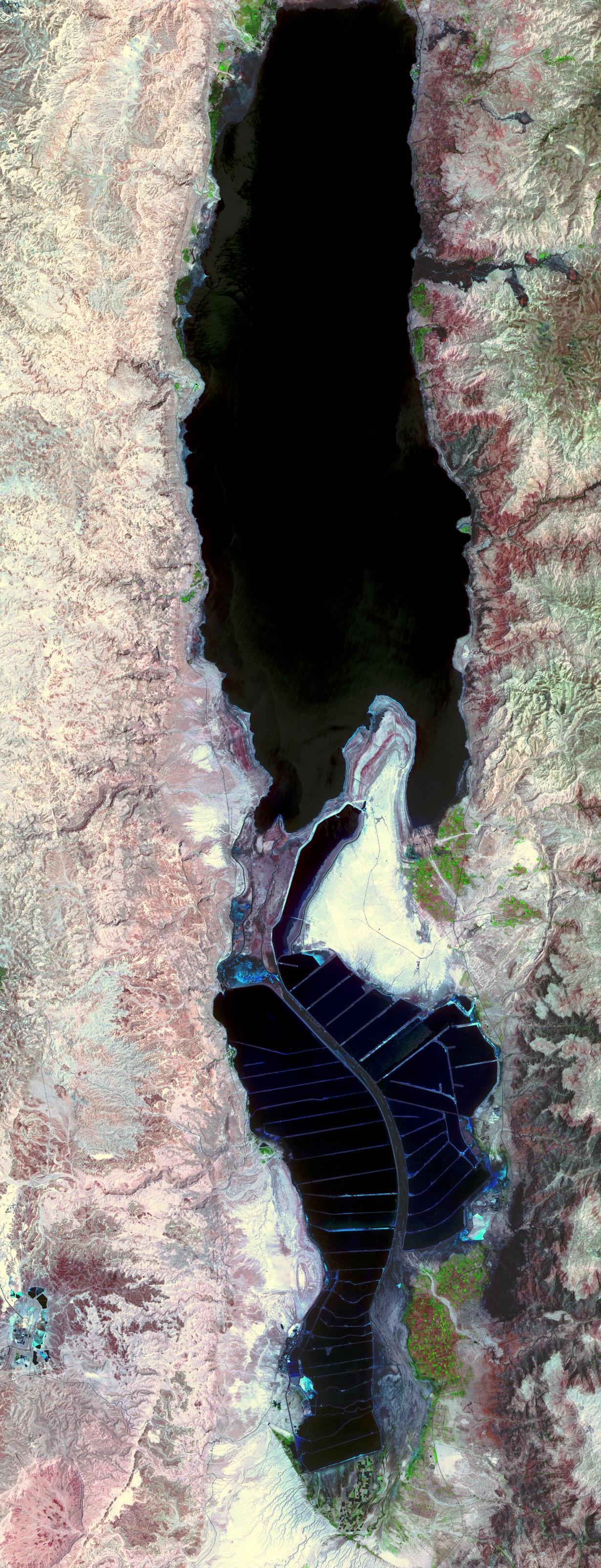
The Dead Sea is the lowest point on Earth at 418 meters below sea level, and also one of the saltiest bodies of water on Earth with a salinity of about 300 parts-per-thousand (nine times greater than ocean salinity). It is located on the border between Jordan and Israel, and is fed by the Jordan River. The Dead Sea is located in the Dead Sea Rift, formed as a result of the Arabian tectonic plate moving northward away from the African Plate. The mineral content of the Dead Sea is significantly different from that of ocean water, consisting of approximately 53% magnesium chloride, 37% potassium chloride and 8% sodium chloride. In the early part of the 20th century, the Dead Sea began to attract interest from chemists who deduced that the Sea was a natural deposit of potash and bromine. From the Dead Sea brine, Israel and Jordan produce 3.8 million tons potash, 200,000 tons elemental bromine, 45,000 tons caustic soda, 25,000 tons magnesium metal, and sodium chloride. Both countries use extensive salt evaporation pans that have essentially diked the entire southern end of the Dead Sea.
With its 14 spectral bands from the visible to the thermal infrared wavelength region, and its high spatial resolution of 15 to 90 meters (about 50 to 300 feet), ASTER images Earth to map and monitor the changing surface of our planet.
ASTER is one of five Earth-observing instruments launched December 18, 1999, on NASA's Terra satellite. The instrument was built by Japan's Ministry of Economy, Trade and Industry. A joint U.S./Japan science team is responsible for validation and calibration of the instrument and the data products.
The broad spectral coverage and high spectral resolution of ASTER provides scientists in numerous disciplines with critical information for surface mapping, and monitoring of dynamic conditions and temporal change. Example applications are: monitoring glacial advances and retreats; monitoring potentially active volcanoes; identifying crop stress; determining cloud morphology and physical properties; wetlands evaluation; thermal pollution monitoring; coral reef degradation; surface temperature mapping of soils and geology; and measuring surface heat balance.
The U.S. science team is located at NASA's Jet Propulsion Laboratory, Pasadena, Calif. The Terra mission is part of NASA's Science Mission Directorate.
Size: 18.5 by 48.1 kilometers (11.5 by 29.8 miles)
Location: 31.4 degrees North latitude, 35.4 degrees East longitude
Orientation: North at top
Image Data: ASTER bands 3, 2, and 1
Original Data Resolution: 15 meters (49.2 feet)
Dates Acquired: May 3, 2005
