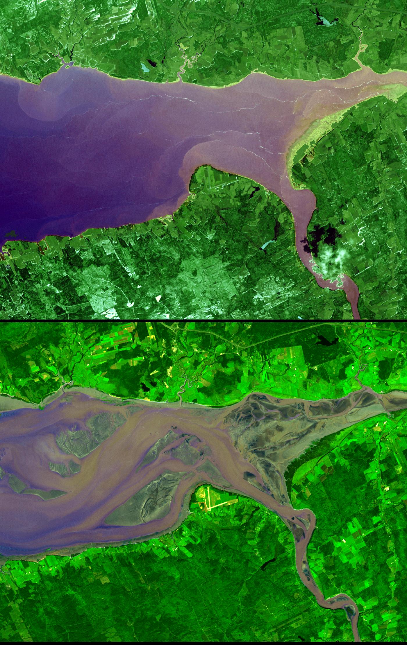
The highest tides on Earth occur in the Minas Basin, the eastern extremity of the Bay of Fundy, Nova Scotia, Canada, where the tide range can reach 16 meters when the various factors affecting the tides are in phase. The primary cause of the immense tides of Fundy is a resonance of the Bay of Fundy-Gulf of Maine system. The system is effectively bounded at this outer end by the edge of the continental shelf with its approximately 40:1 increase in depth. The system has a natural period of approximately 13 hours, which is close to the 12h25m period of the dominant lunar tide of the Atlantic Ocean. Like a father pushing his daughter on a swing, the gentle Atlantic tidal pulse pushes the waters of the Bay of Fundy-Gulf of Maine basin at nearly the optimum frequency to cause a large to-and-fro oscillation. The greatest slosh occurs at the head (northeast end) of the system. The high tide image (top) was acquired April 20, 2001, and the low tide image (bottom) was acquired September 30, 2002. The images cover an area of 16.5 by 21 km, and are centered near 64 degrees west longitude and 45.5 degrees north latitude.
With its 14 spectral bands from the visible to the thermal infrared wavelength region, and its high spatial resolution of 15 to 90 meters (about 50 to 300 feet), ASTER images Earth to map and monitor the changing surface of our planet.
ASTER is one of five Earth-observing instruments launched December 18, 1999, on NASA's Terra satellite. The instrument was built by Japan's Ministry of Economy, Trade and Industry. A joint U.S./Japan science team is responsible for validation and calibration of the instrument and the data products.
The broad spectral coverage and high spectral resolution of ASTER provides scientists in numerous disciplines with critical information for surface mapping, and monitoring of dynamic conditions and temporal change. Example applications are: monitoring glacial advances and retreats; monitoring potentially active volcanoes; identifying crop stress; determining cloud morphology and physical properties; wetlands evaluation; thermal pollution monitoring; coral reef degradation; surface temperature mapping of soils and geology; and measuring surface heat balance.
The U.S. science team is located at NASA's Jet Propulsion Laboratory, Pasadena, Calif. The Terra mission is part of NASA's Science Mission Directorate.
Size: 16.5 by 21 kilometers (10.2 by 13 miles)
Location: 45.4 degrees North latitude, 64 degrees West longitude
Image Data: ASTER bands 3, 2, and 1
Original Data Resolution: 15 meters (49.2 feet)
Dates Acquired: September 30, 2002
