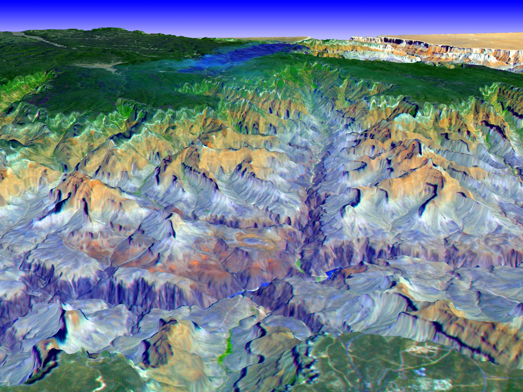
This simulated true color perspective view over the Grand Canyon was created from Advanced Spaceborne Thermal Emission and Reflection Radiometer (ASTER) data acquired on May 12, 2000. The Grand Canyon Village is in the lower foreground; the Bright Angel Trail crosses the Tonto Platform, before dropping down to the Colorado Village and then to the Phantom Ranch (green area across the river). Bright Angel Canyon and the North Rim dominate the view. At the top center of the image the dark blue area with light blue haze is an active forest fire.
ASTER is one of five Earth-observing instruments launched December 18, 1999, on NASA's Terra satellite. The instrument was built by Japan's Ministry of Economy, Trade and Industry. A joint U.S./Japan science team is responsible for validation and calibration of the instrument and the data products.
The broad spectral coverage and high spectral resolution of ASTER provides scientists in numerous disciplines with critical information for surface mapping, and monitoring of dynamic conditions and temporal change. Example applications are: monitoring glacial advances and retreats; monitoring potentially active volcanoes; identifying crop stress; determining cloud morphology and physical properties; wetlands evaluation; thermal pollution monitoring; coral reef degradation; surface temperature mapping of soils and geology; and measuring surface heat balance.
The U.S. science team is located at NASA's Jet Propulsion Laboratory, Pasadena, Calif. The Terra mission is part of NASA's Science Mission Directorate.
Size: 5 km in foreground to 40 km
Location: 36.3 degrees north latitude, 112 degrees west longitude
Orientation: North-northeast at top
Original Data Resolution: ASTER 15 meters
Dates Acquired: May 12, 2000
