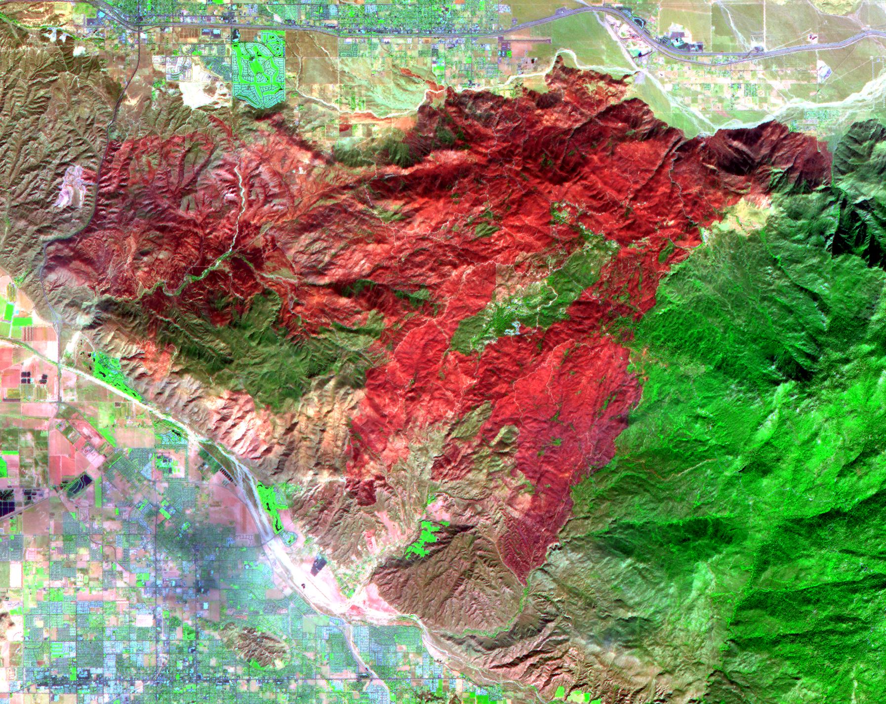
The Esperanza fire started on October 26 in the dry brush near Palm Springs, CA. By the time it was contained 6 days later, the fire had consumed 40,200 acres, and destroyed 34 homes and 20 outbuildings. Racing through grass, brush, and timber, the blaze had forced hundreds to evacuate, and it killed five firefighters who were working to protect homes. Fire officials are reporting the cause of the blaze as arson. In this ASTER image composite of visible and infrared bands, burned areas are shown in shades of red, vegetation is green, brown vegetation is brown and asphalt and concrete are blue-gray.
With its 14 spectral bands from the visible to the thermal infrared wavelength region, and its high spatial resolution of 15 to 90 meters (about 50 to 300 feet), ASTER images Earth to map and monitor the changing surface of our planet.
ASTER is one of five Earth-observing instruments launched December 18, 1999, on NASA's Terra satellite. The instrument was built by Japan's Ministry of Economy, Trade and Industry. A joint U.S./Japan science team is responsible for validation and calibration of the instrument and the data products.
The broad spectral coverage and high spectral resolution of ASTER provides scientists in numerous disciplines with critical information for surface mapping, and monitoring of dynamic conditions and temporal change. Example applications are: monitoring glacial advances and retreats; monitoring potentially active volcanoes; identifying crop stress; determining cloud morphology and physical properties; wetlands evaluation; thermal pollution monitoring; coral reef degradation; surface temperature mapping of soils and geology; and measuring surface heat balance.
The U.S. science team is located at NASA's Jet Propulsion Laboratory, Pasadena, Calif. The Terra mission is part of NASA's Science Mission Directorate.
Size: 21.4 by 26.9 kilometers (13.2 by 16.6 miles)
Location: 33.6 degrees North latitude, 116.8 degrees West longitude
Orientation: North at top
Image Data: ASTER Bands 7, 3 and 1
Original Data Resolution: ASTER 15 meters (49.2 feet) and 30 meters (98.4 feet)
Dates Acquired: November 3, 2006
