 |  |  |  |
| Area "a" | Area "b" | Area "c" | Area "d" |
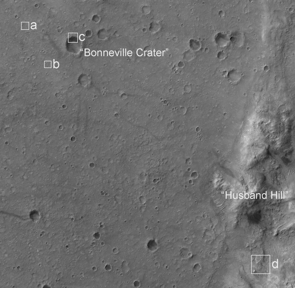
This image from the High Resolution Imaging Science Experiment camera on NASA's Mars Reconnaissance Orbiter shows the landing site of the Mars Exploration Rover Spirit. The impact crater in the upper left portion of the image is "Bonneville Crater," which was investigated by Spirit shortly after landing. In the lower right portion of the image is "Husband Hill," a large hill that Spirit climbed and spent much of its now nearly three-year mission.
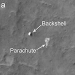
The bright irregularly shaped feature in area "a" of the image is Spirit's parachute, now lying on the Martian surface. Near the parachute is the cone-shaped back shell, which helped protect Spirit's lander during its seven-month journey to Mars. The back shell appears relatively undamaged by its impact with the Martian surface. Wrinkles and folds in the parachute fabric are clearly visible.
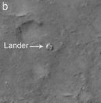
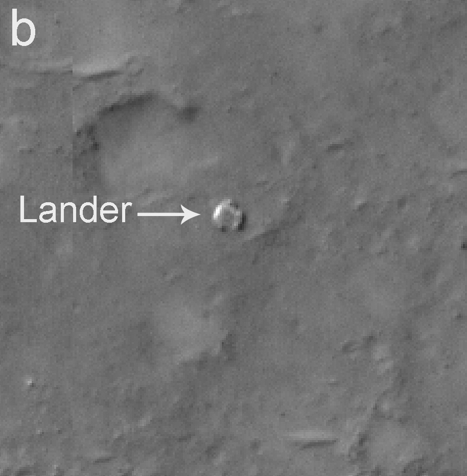
Area "b" of the image shows Spirit's lander. The crater in the upper left portion of the image, just northwest of the lander, was informally named "Sleepy Hollow" by the Mars Exploration Rover team.
Area "c" of the image shows Spirit's heat shield at the edge of Bonneville Crater.
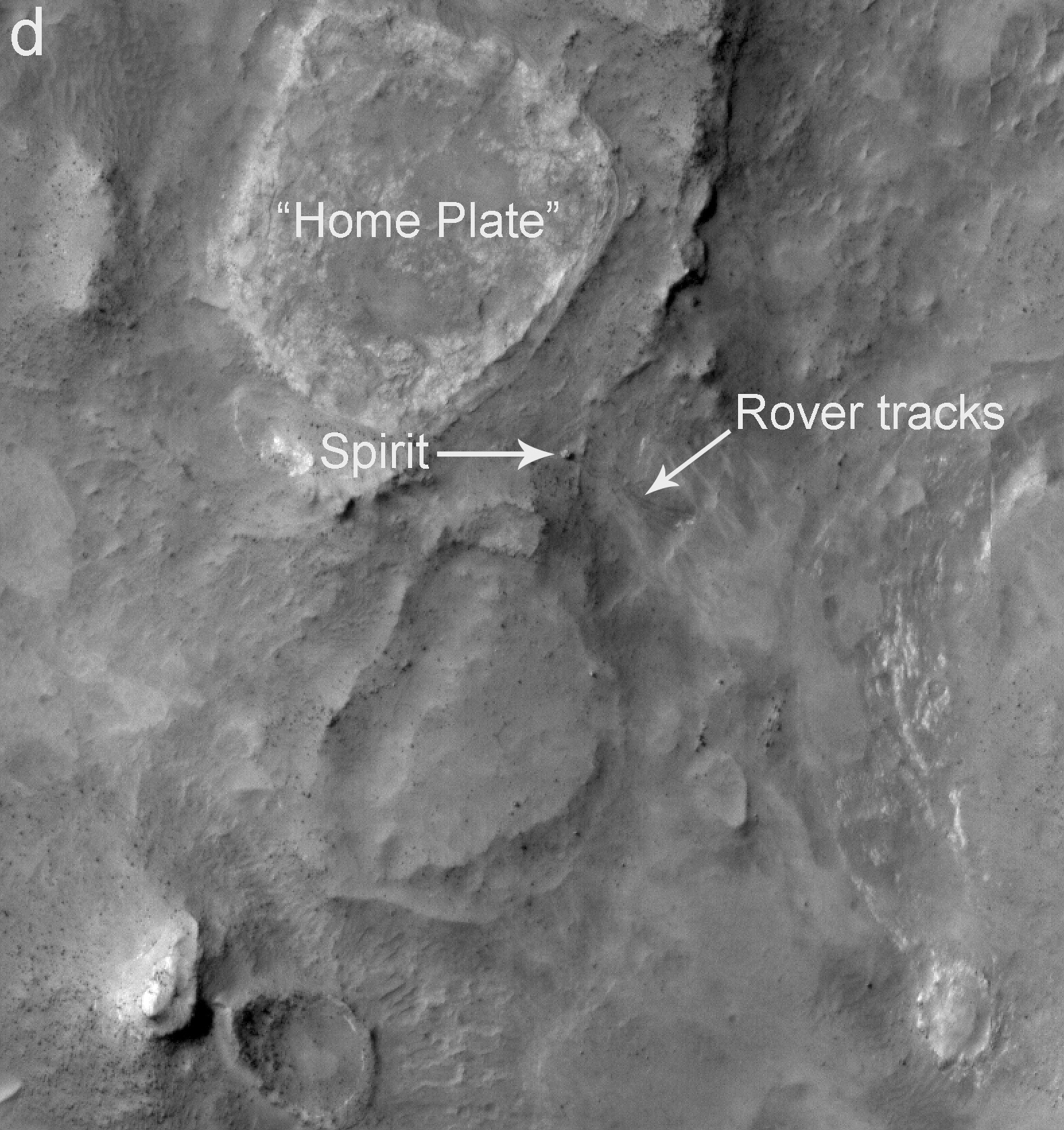
Area "d" of the image shows the current location of Spirit. Toward the top of the image is "Home Plate," a plateau of layered rocks that Spirit explored during the early part of its third year on Mars. Spirit itself is clearly seen just southeast of Home Plate. Also visible are the tracks made by the rover before it arrived at its current location.
This image is a small portion of an image (catalogued as PSP_001513_1655) taken by the High Resolution Imaging Science Experiment camera on Sept. 29, 2006. The full image is centered at minus 7.8 degrees latitude, 279.5 degrees east longitude. The image is oriented such that north is toward the top. The range to the target site was 297 kilometers (185.6 miles). At this distance the image scale is 29.7 centimeters (11.7 inches) per pixel (with 1 by 1 binning), so objects as small as about 89 centimeters (35 inches) across are resolved. The image was taken at 3:30 p.m. local Mars time. The scene is illuminated from the west with a solar-incidence angle of 59.7 degrees, which means the sun was about 30.3 degrees above the horizon. When the image was taken, the season on Mars was southern winter.
Images from the High Resolution Imaging Science Experiment and additional information about the Mars Reconnaissance Orbiter are available online at: http://www.nasa.gov/mro or http://HiRISE.lpl.arizona.edu.
For information about NASA and agency programs on the Web, http://www.nasa.gov.
NASA's Jet Propulsion Laboratory, a division of the California Institute of Technology in Pasadena, manages the Mars Reconnaissance Orbiter for NASA's Science Mission Directorate, Washington. Lockheed Martin Space Systems is the prime contractor for the project and built the spacecraft. The High Resolution Imaging Science Experiment camera was built by Ball Aerospace Corporation and is operated by the University of Arizona.
 Planetary Data System


