- Original Caption Released with Image:
-
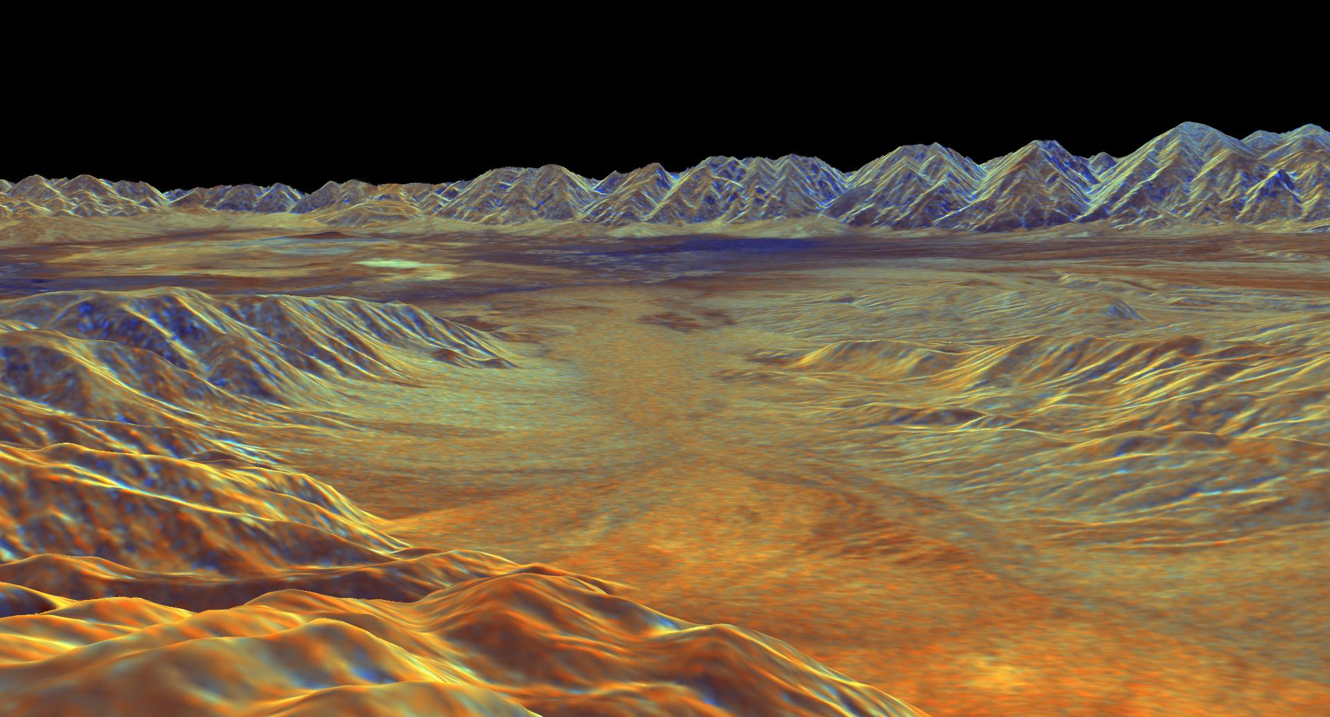
This is a three-dimensional perspective view of Saline Valley, about 30 km (19 miles) east of the town of Independence, California created by combining two spaceborne radar images using a technique known as interferometry. Visualizations like this one are helpful to scientists because they clarify the relationships of the different types of surfaces detected by the radar and the shapes of the topographic features such as mountains and valleys. The view is looking southwest across Saline Valley. The high peaks in the background are the Inyo Mountains, which rise more than 3,000 meters (10,000 feet) above the valley floor. The dark blue patch near the center of the image is an area of sand dunes. The brighter patches to the left of the dunes are the dry, salty lake beds of Saline Valley. The brown and orange areas are deposits of boulders, gravel and sand known as alluvial fans. The image was constructed by overlaying a color composite radar image on top of a digital elevation map.
The radar image was taken by the Spaceborne Imaging Radar-C/X-bandSynthetic Aperture Radar (SIR-C/X-SAR) on board the space shuttleEndeavour in October 1994. The digital elevation map was producedusing radar interferometry, a process in which radar data are acquired on different passes of the space shuttle. The two data passes are compared to obtain elevation information. The elevation data were derived from a 1,500-km-long (930-mile) digital topographic map processed at JPL. Radar image data are draped over the topography to provide the color with the following assignments: red is L-band vertically transmitted, vertically received; green is C-band vertically transmitted, vetically received; and blue is the ratio of C-band vertically transmitted, vertically received to L-band vertically transmitted, vertically received. This image is centered near 36.8 degrees north latitude and 117.7 degrees west longitude. No vertical exaggeration factor has been applied to the data. SIR-C/X-SAR, a joint mission of the German, Italian, and the United States space agencies, is part of NASA's Mission to Planet Earth.
- Image Credit:
-
NASA/JPL
Image Addition Date: -
1999-04-15
|
