- Original Caption Released with Image:
-
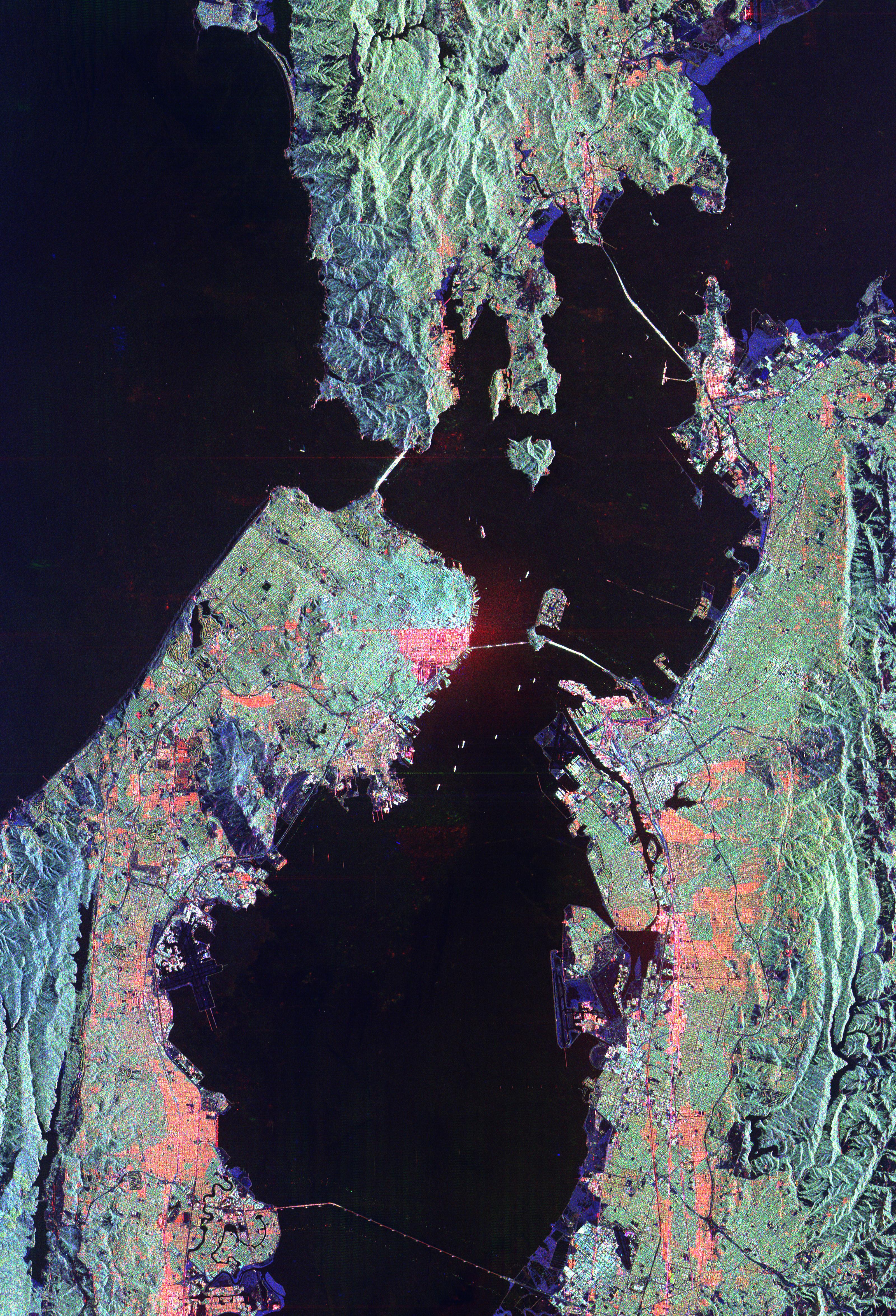
This image of San Francisco, California shows how the radar distinguishes between densely populated urban areas and nearby areas that are relatively unsettled. Downtown San Francisco is at the center and the city of Oakland is at the right across the San Francisco Bay. Some city areas, such as the South of Market, called the SOMA district in San Francisco, appear bright red due to the alignment of streets and buildings to the incoming radar beam. Various bridges in the area are also visible including the Golden Gate Bridge (left center) at the opening of San Francisco Bay, the Bay Bridge (right center) connecting San Francisco and Oakland, and the San Mateo Bridge (bottom center). All the dark areas on the image are relatively smooth water: the Pacific Ocean to the left, San Francisco Bay in the center, and various reservoirs. Two major faults bounding the San Francisco-Oakland urban areas are visible on this image. The San Andreas fault, on the San Francisco peninsula, is seen in the lower left of the image. The fault trace is the straight feature filled with linear reservoirs which appear dark. The Hayward fault is the straight feature on the right side of the image between the urban areas and the hillier terrain to the east. The image is about 42 kilometers by 58 kilometers (26 miles by 36 miles) with north toward the upper right. This area is centered at 37.83 degrees north latitude, 122.38 degrees east longitude.
The image was acquired by the Spaceborne Imaging Radar-C/X-band Synthetic Aperture (SIR-C/X-SAR) imaging radar when it flew aboard the space shuttle Endeavour on October 3, 1994. SIR-C/X-SAR, a joint mission of the German, Italian and the United States space agencies, is part of NASA's Mission to Planet Earth.
- Image Credit:
-
NASA/JPL
Image Addition Date: -
1999-04-15
|
