- Original Caption Released with Image:
-
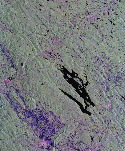
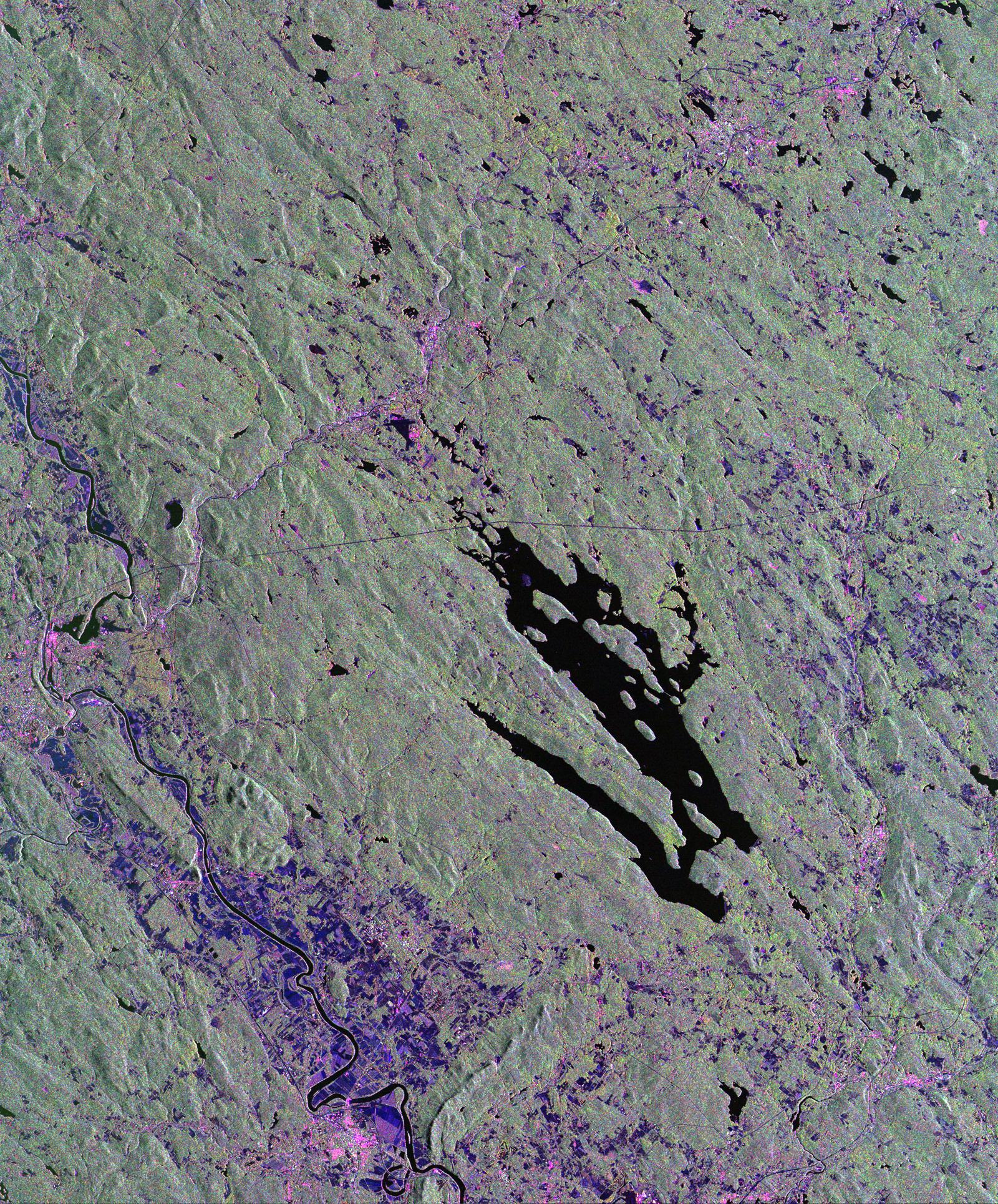
This is a radar image of the area surrounding the Harvard Forest in north-central Massachusetts that has been operated as a ecological research facility by Harvard University since 1907. At the center of the image is the Quabbin Reservoir, and the Connecticut River is at the lower left of the image. The Harvard Forest itself is just above the reservoir. Researchers are comparing the naturally occurring physical disturbances in the forest and the recent and projected chemical disturbances and their effects on the forest ecosystem. Agricultural land appears dark blue/purple, along with low shrub vegetation and some wetlands. Urban development is bright pink; the yellow to green tints are conifer-dominated vegetation with the pitch pine sand plain at the middle left edge of the image appearing very distinctive. The green tint may indicate pure pine plantation stands, and deciduous broadleaf trees appear gray/pink with perhaps wetter sites being pinker.
This image was acquired by the Spaceborne Imaging Radar-C/X-Band Synthetic Aperture Radar (SIR-C/X-SAR) aboard the space shuttle Endeavour. SIR-C/X-SAR, a joint mission of the German, Italian and the United States space agencies, is part of NASA's Mission to Planet Earth. The image is centered at 42.50 degrees North latitude and 72.33 degrees West longitude and covers an area of 53 kilometers 63 by kilometers (33 miles by 39 miles). The colors in the image are assigned to different frequencies and polarizations of the radar as follows: red is L-band horizontally transmitted and horizontally received; green is L-band horizontally transmitted and vertically received; and blue is C-band horizontally transmitted and horizontally received.
- Image Credit:
-
NASA/JPL
Image Addition Date: -
1999-04-15
|