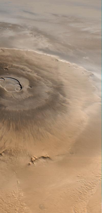
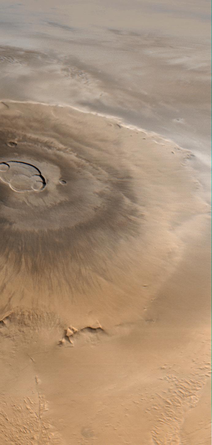
Olympus Mons is a mountain of mystery. Taller than three Mount Everests and about as wide as the entire Hawaiian Island chain, this giant volcano is nearly as flat as a pancake. That is, its flanks typically only slope 2° to 5°.
The Mars Orbiter Camera (MOC) obtained this spectacular wide-angle view of Olympus Mons on Mars Global Surveyor's 263rd orbit, around 10:40 p.m. PDT on April 25, 1998. In the view presented here, north is to the left and east is up. The spacecraft was traveling from north to south (left to right). Although the camera looks straight down (towards the nadir) and cannot be pointed to the side, the wide angle camera has such a large field of view (it sees from horizon to horizon) that, in effect, it provides side looking views. Unlike some other MOC images, that have had to be warped to provide a view as if seen from a certain direction and altitude, this image shows what the camera saw without additional processing. It is easy to imagine that you are looking out a window at the surface of Mars from about 900 km (560 miles) up.
The image was taken on a cool, crisp winter morning. The west side of the volcano (lower portion of view, above) was clear and details on the surface appear very sharp. The skies above the plains to the east of Olympus Mons (upper portion of view) were cloudy. Clouds were lapping against the lower east flanks of this 26 kilometers (16 miles) high volcano, but the summit skies were clear.
When Mars Global Surveyor attains its Mapping Orbit in March 1999, the MOC wide angle camera system will be used to make daily, global maps of martian clouds and weather systems. The wide angle images will resemble weather satellite pictures of Earth, and will help the Mars science teams plan their observations and test computer-driven Mars weather prediction models.
Malin Space Science Systems and the California Institute of Technology built the MOC using spare hardware from the Mars Observer mission. MSSS operates the camera from its facilities in San Diego, CA. The Jet Propulsion Laboratory's Mars Surveyor Operations Project operates the Mars Global Surveyor spacecraft with its industrial partner, Lockheed Martin Astronautics, from facilities in Pasadena, CA and Denver, CO.
 Planetary Data System


