The Mars Global Surveyor (MGS) Mars Orbiter Camera (MOC) orbits the red planet twelve times each day. The number of pictures that MOC can take varies from orbit to orbit, depending upon whether the data are being stored in MGS's onboard tape recorder for playback at a later time, or whether the data are being sent directly back to Earth via a real-time radio link. More data can be acquired during orbits with real-time downlink.
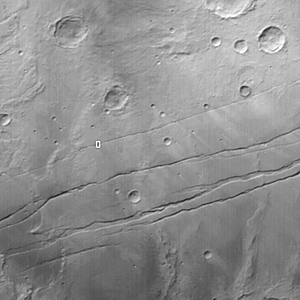
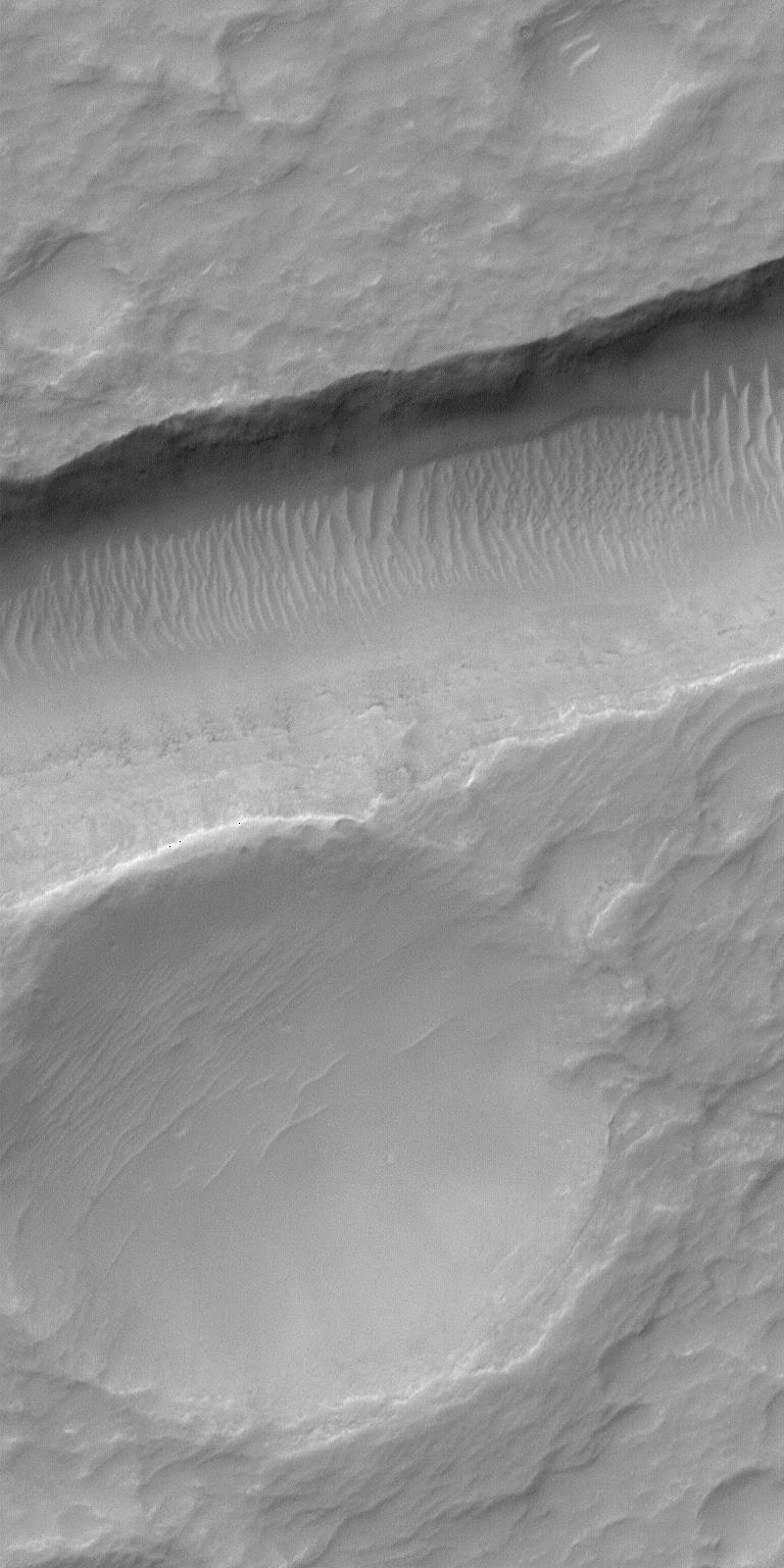
During real-time orbits, the MOC team often will take a few random or semi-random pictures in between the carefully-selected, hand-targeted images. On rare occasions, one of these random pictures will surprise the MOC team. The picture shown here is an excellent example, because the high resolution view (top) is centered so nicely on a trough and an adjacent, shallow crater that it is as if someone very carefully selected the target for MOC. The high-resolution view covers an area only 1.1 km (0.7 mi) wide by 2.3 km (1.4 mi) long. Hitting a target such as this with such a small image is very difficult to do, on purpose, because there are small uncertainties in the predicted orbit, the maps used to select targets, and the minor adjustments of spacecraft pointing at any given moment. Nevertheless, a very impressive image was received.
The high resolution view crosses one of the troughs of the Sirenum Fossae near 31.2°S, 152.3°W. The context image (above) was acquired at the same time as the high resolution view on July 23, 2000. The small white box shows the location of the high resolution picture. The lines running diagonally across the context image from upper right toward lower left are the Sirenum Fossae troughs, formed by faults that are radial to the volcanic region of Tharsis. Both pictures are illuminated from the upper left. The scene shows part of the martian southern hemisphere nearly autumn.

