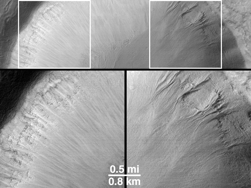
How can martian gullies -- thought to be caused in part by seepage and runoff of liquid water -- be distinguished from the more typical, "dry" slope erosion processes that also occur on Mars? For one thing, most -- though not all -- of the gully landforms occur on slopes that face away from the martian equator and toward the pole. For another, slopes that face toward the equator exhibit the same types of features as seen on nearly every other non-gullied slope on Mars.
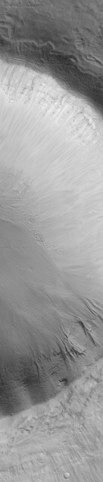
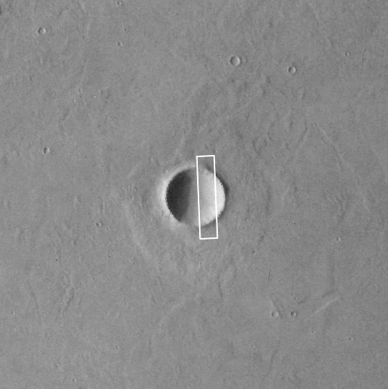
The example shown here comes from northwestern Elysium Planitia in the martian northern hemisphere. The Mars Global Surveyor (MGS) Mars Orbiter Camera (MOC) high resolution view (A, left) shows a portion of a 10 kilometer-(6.2 mi)-diameter meteor impact crater at a resolution of about 9 meters (29.5 ft) per pixel. The crater is shown in the context image (B, middle). The north-facing (or, pole-ward) slope in the MOC view is shadowed because sunlight illuminates the scene from the lower left. In this shadowed area, a series of martian gullies -- defined by their erosional alcoves, deep channels, and apron deposits -- are seen. On the sunlit south-facing (or equator-ward) slope, a scene more typical of most martian impact craters is present -- the upper slopes show layered bedrock, the lower slopes show light-toned streaks of dry debris that has slid down the slope forming talus deposits that are distinctly different from the lobe-like form of gully aprons. The picture in (C) has been rotated so that the two slopes -- one with gullies (right) and one without (left) -- can be compared.
The crater is located at 36.7°N, 252.3°W. The MOC image was acquired in November 1999 and covers an area 3 km (1.9 mi) wide by 14 km (8.7 mi) long; north is toward the upper right (in A) and it is illuminated by sunlight from the lower left. The Viking 1 orbiter context image (B) was obtained in 1978 and is illuminated from the left; north is up. The MOC image has been rotated in the Explanatory Figure (C) such that north is toward the upper left, illumination is from the lower right.