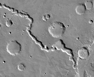
Nirgal Vallis is an ancient valley thought for nearly 3 decades to have been carved, in part, by running water at some time far back in the martian past. Today the valley is, like the rest of Mars, quite dry. However, some of the high resolution Mars Global Surveyor (MGS) Mars Orbiter Camera (MOC) images reveal small gullies on the walls of this valley system. An example is shown here (above, left), in which more than 14 channels nearly 1 kilometer (0.6 miles) long run down the south-facing slope of the Nirgal Vallis wall. Each narrow channel starts at about the same position below the top of the valley wall, indicating that there is a layer along which a liquid -- most likely, water -- has percolated until it reached the cliff, then ran down hill to form the channels and the fan-shaped aprons at the bottom of the slope. Some of the apron deposits seem to cover the dunes on the floor of the valley (lower 1/3 of the image), suggesting that the channels and aprons formed more recently than the dunes. The fact that neither the dunes nor the aprons and channels have impact craters on them suggests that these features are all geologically young, meaning a few million years at most, a few days or weeks at least.
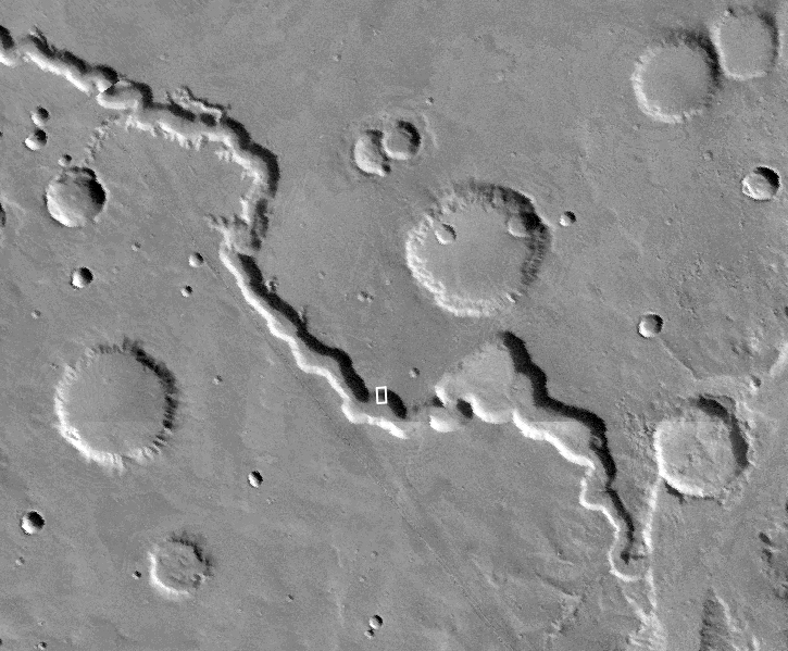
Nirgal Vallis is the one location where martian gullies thought to be related to recent groundwater seepage have been found closer to the equator than 30° latitude. All of the features in Nirgal, however, occur close to 30° -- they are all between 27°S and 30°S. The MOC image is near 29.7°S, 38.6°W, and was obtained July 12, 1999. The MOC picture covers an area approximately 2.3 km (1.4 mi) wide by 2.8 km (1.7 mi) long. Sunlight illuminates the MOC scene from the upper left, and north is up. The context view (right) is a mosaic of Viking orbiter images illuminated from the upper right from the U.S. Geological Survey Mars Digital Mosaic maps. The small white box in the context frame (just below center of image) shows the location of the high resolution MOC view.
It is ironic to note that one of the first pictures returned to Earth from MOC, back on September 21, 1997, showed similar small channels and aprons on the wall of Nirgal Vallis -- but their significance was not realized at the time.
 Planetary Data System


