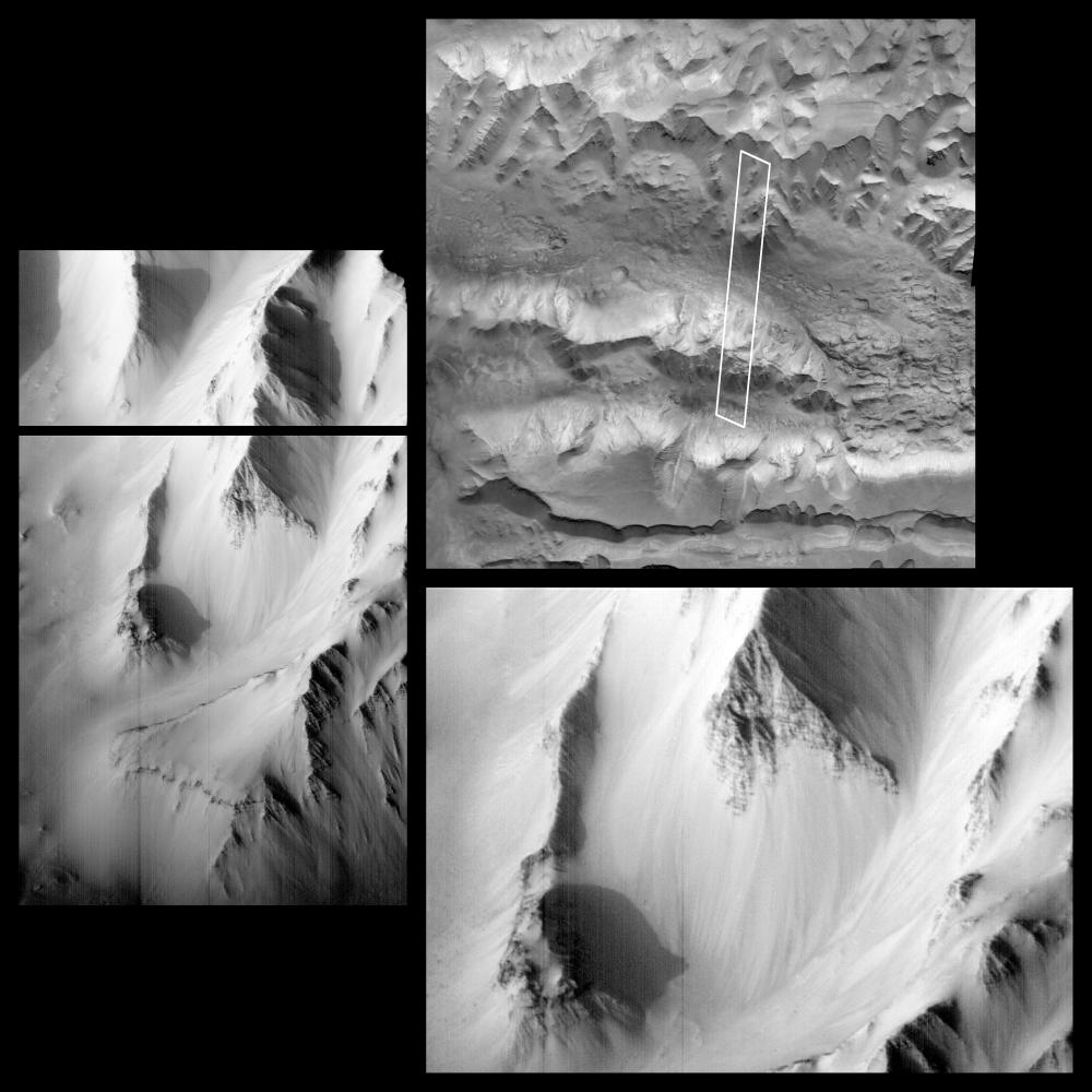
On October 3, 1997, the MOC acquired this image of the western Tithonium Chasma/Ius Chasma portion of the Valles Marineris, centered at 6.6°S, 90.4°W, at 1:16 PM PDT. Although the lighting beneath the spacecraft was very poor, the camera was canted towards the sun, and the illumination was equivalent to roughly 5 PM local time (the sun was about 17° above the horizon). In the image, the canyon floors are mostly shadowed, but steep slopes in the area are exquisitely highlighted.
The area outlined in the upper right image, the highest resolution view of the region previously available, is 6.6 km (4 miles) wide by 55.6 km (34.5 miles) long. The ridges to the north and south are about 4000 m (13,000 feet) above the floor of the troughs, but in the area photographed, the relief is slightly lower (about 3000 m, or 10,000 feet). The top portion of the image is shown on the left, and a section of that image is shown enlarged at lower right. The scale is 6.45 m/pixel across the image by 9.65 m/pixel down the image. The left and lower right images are available at higher resolution as PIA01022 and PIA01023, respectively.
Launched on November 7, 1996, Mars Global Surveyor entered Mars orbit on Thursday, September 11, 1997. The original mission plan called for using friction with the planet's atmosphere to reduce the orbital energy, leading to a two-year mapping mission from close, circular orbit (beginning in March 1998). Owing to difficulties with one of the two solar panels, aerobraking was suspended in mid-October and resumed in November 8. Many of the original objectives of the mission, and in particular those of the camera, are likely to be accomplished as the mission progresses.
Malin Space Science Systems and the California Institute of Technology built the MOC using spare hardware from the Mars Observer mission. MSSS operates the camera from its facilities in San Diego, CA. The Jet Propulsion Laboratory's Mars Surveyor Operations Project operates the Mars Global Surveyor spacecraft with its industrial partner, Lockheed Martin Astronautics, from facilities in Pasadena, CA and Denver, CO.
 Planetary Data System


