- Original Caption Released with Image:
-
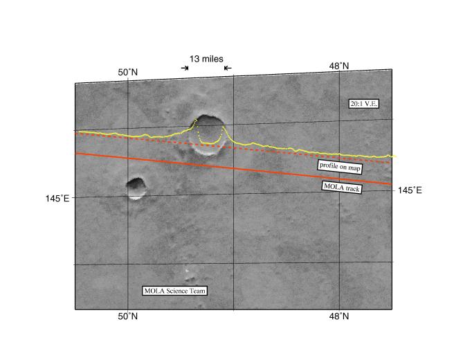
Among the myriad of interesting landforms sampled by MOLA on its first traverse across the Red Planet on 15 September 1997 is this 13-mile (21-kilometer) diameter impact crater located at ~ 48°N. The figure shows the topography, the computed position of the spacecraft groundtrack (solid line) and the track adjusted to correct for image location error (dashed line). The topographic profile provides some of the first indications of how landscape modification has operated in Martian geologic history. The relief of the crater rim, in combination with the steepness (over 20°) of the inner crater wall, are intriguing in that most craters of this size are much more subdued. The shape of the outer ejecta blanket of the crater likely indicates impact into an H2O rich crust. Issues concerning how craters such as this can be used to understand the properties of the uppermost crust of Mars in regions where the role of water and other volatiles may be important can be addressed with the high spatial and vertical resolution topographic profiles that will be acquired by MOLA once it starts its detailed mapping of the Red Planet in March of 1998.
- Image Credit:
-
NASA/JPL/GSFC
Image Addition Date: -
1997-10-13
|