- Original Caption Released with Image:
-
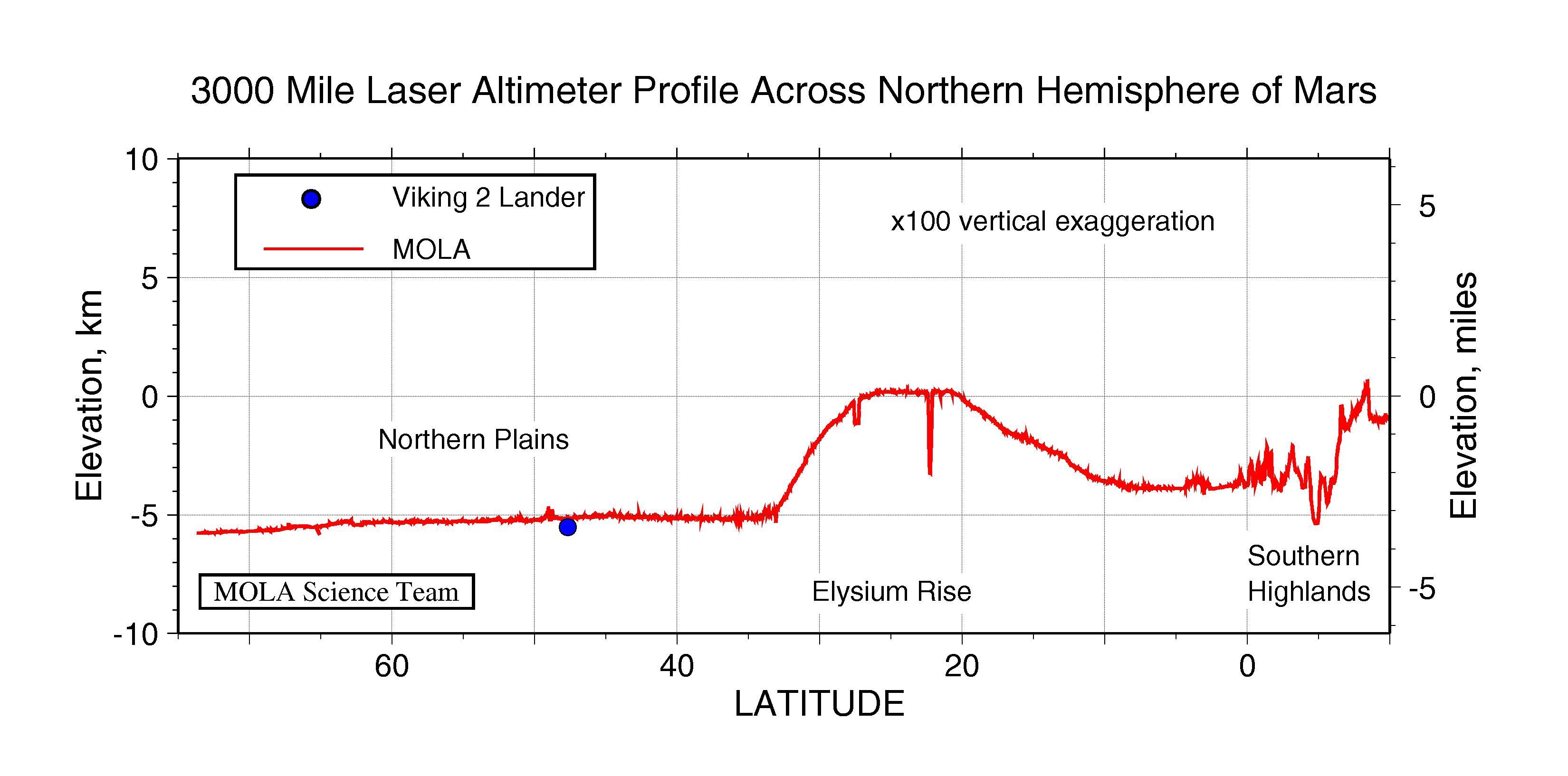
Topographic profile across the northern hemisphere of Mars from the Mars Orbiter Laser Altimeter (MOLA). The profile was obtained during the Mars Global Surveyor Capture Orbit Calibration Pass on September 15, 1997 and represents 20 minutes of data collection. The profile has a length of approximately 3000 miles (5000 kilometers). The large bulge is the western part of the Elysium rise, the second largest volcanic province on Mars, and shows over 3 miles (5 kilometers) of vertical relief. This area contains deep chasms that reflect tectonic, volcanic and erosional processes. In contrast is the almost 1featureless1 northern plains region of Mars, which shows only hundreds of meters of relief at scales the size of the United States. Plotted for comparison is the elevation of the Viking Lander 2 site, which is located 275 miles (445 kilometers) west of the profile. At the southernmost extent of the trace is the transition from the northern plains to the ancient southern highlands. Characterizing the fine-scale nature of topography in this chaotic region is crucial to testing theories for how the dichotomy between the geologically distinctive northern lowlands and southern uplands formed and subsequently evolved. The spatial resolution of the profile is approximately 1000 feet (330 meters) and the vertical resolution is approximately 3 feet (1 meter). When the Mars Global Surveyor mapping mission commences in March, 1998, the MOLA instrument will collect 72 times as much data every day for a period of two years.
- Image Credit:
-
NASA/JPL/GSFC
Image Addition Date: -
1997-10-13
|
