- Original Caption Released with Image:
-
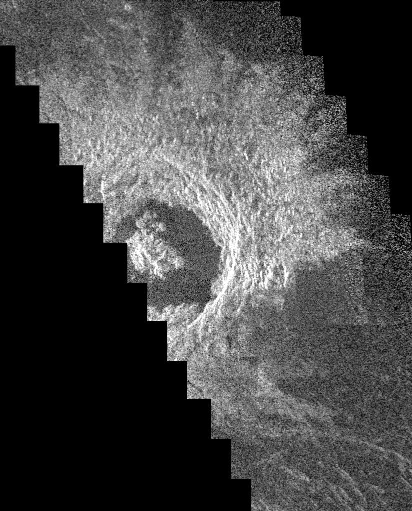
This Magellan image mosaic shows the impact crater Golubkina, first identified in Soviet Venera 15/16 data. The crater is named after Anna Golubkina (1864-1927), a Soviet sculptor. The crater is about 34 kilometers (20.4 miles) across, similar to the size of the West Clearwater impact structure in Canada. The crater Golubkina is located at about 60.5 degrees north latitude, 286.7 degrees east longitude. Magellan data reveal that Golubkina has many characteristics typical of craters formed by a meteorite impact including terraced inner walls, a central peak, and radar bright rough ejecta surrounding the crater. The extreme darkness of the crater floor indicates a smooth surface, perhaps formed by the pounding of lava flows in the crater floor as seen in many lunar impact craters. The radar bright ejecta surrounding the crater indicates a relatively fresh or young crater. Craters with central peaks in the Soviet data range in size from about 10.60 km (6.36 miles) across. The largest crater identified in the Soviet Venera data is 140 km (84 miles) in diameter. This Magellan image strip is approximately 20 km (12 miles) wide and this piece of the image is approximately 100 km (62 miles) long. The image is a mosaic of two orbits obtained in the first Magellan radar test and played back to Earth to the Deep Space Network stations near Goldstone, Calif. and Canberra, Australia, respectively. The resolution of this image is approximately 120 meters (400 feet). The see-saw margins result from the offset of individual radar frames obtained along the orbit. The spacecraft moved from the north (top) to the south, looking to the left.
- Image Credit:
-
NASA/JPL
Image Addition Date: -
1996-03-07
|