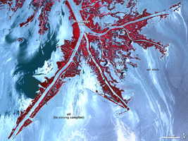
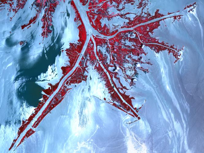
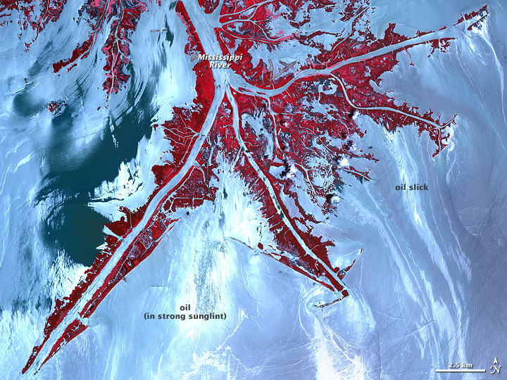
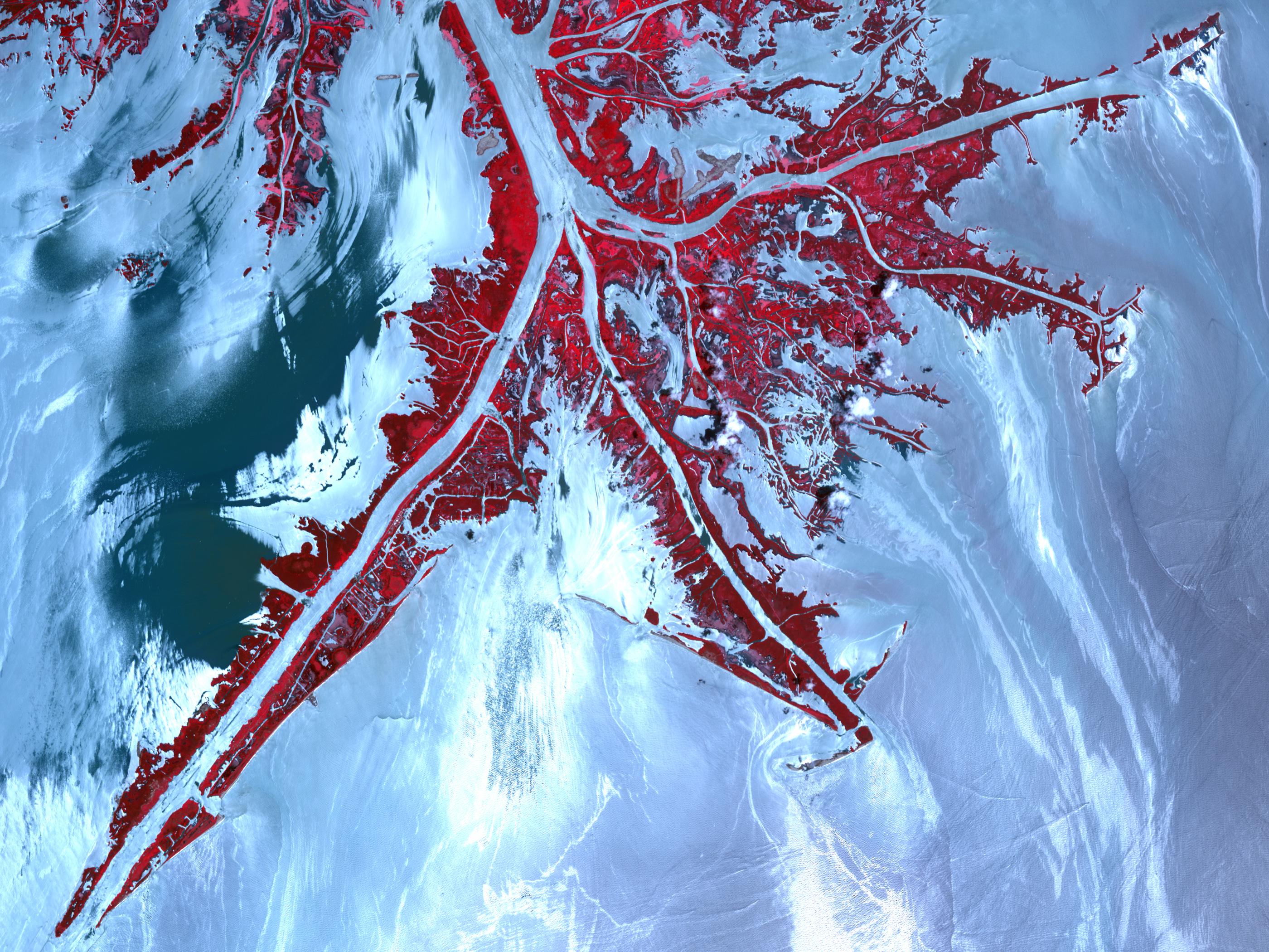
Click on the image for larger annotated versionOn May 24, 2010, the Advanced Spaceborne Thermal Emission and Reflection Radiometer (ASTER) on NASA's Terra satellite captured this false-color, high-resolution view of the very tip of the Mississippi River Delta. Ribbons and patches of oil that have leaked from the Deepwater Horizon well offshore are silver against the light blue color of the adjacent water. Vegetation is red.
In the sunglint region of a satellite image -- where the mirror-like reflection of the Sun gets blurred into a wide, bright strip -- any differences in the texture of the water surface are enhanced. Oil smoothes the water, making it a better "mirror." Oil-covered waters are very bright in this image, but, depending on the viewing conditions (time of day, satellite viewing angle, slick location), oil-covered water may look darker rather than brighter.
The relative brightness of the oil from place to place is not necessarily an indication of the amount of oil. Any oil located near the precise spot where the Sun's reflection would appear if the surface of the Gulf were perfectly smooth and calm is going to look very bright in these images. The cause of hte dark patch of water in the upper left quadrant of the image is unknown. It may indicate the use of chemical dispersants, skimmers, or booms, or it may be the result of natural differences in turbidity, salinity, or organic matter in the coastal waters.
With its 14 spectral bands from the visible to the thermal infrared wavelength region and its high spatial resolution of 15 to 90 meters (about 50 to 300 feet), ASTER images Earth to map and monitor the changing surface of our planet. ASTER is one of five Earth-observing instruments launched December 18, 1999, on NASA's Terra. The instrument was built by Japan's Ministry of Economy, Trade and Industry. A joint U.S./Japan science team is responsible for validation and calibration of the instrument and the data products.
The broad spectral coverage and high spectral resolution of ASTER provides scientists in numerous disciplines with critical information for surface mapping and monitoring of dynamic conditions and temporal change. Example applications are: monitoring glacial advances and retreats; monitoring potentially active volcanoes; identifying crop stress; determining cloud morphology and physical properties; wetlands evaluation; thermal pollution monitoring; coral reef degradation; surface temperature mapping of soils and geology; and measuring surface heat balance.
The ASTER U.S. science team is located at NASA's Jet Propulsion Laboratory, Pasadena, Calif. The Terra mission is part of NASA's Science Mission Directorate, Washington, D.C.
More information about ASTER is available at http://asterweb.jpl.nasa.gov/.
Text courtesy of Rebecca Lindsey, NASA Earth Observatory. Image created by Jesse Allen.
 Planetary Data System


