 |
 |
| Figure 1 | Figure 2 |
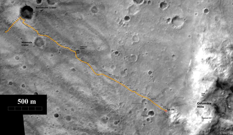
Spirit Total Traverse Map (sol 190, July 16, 2004)
In figure 1, the yellow line on this map illustrates the total path traveled by
NASA's Mars Exploration Rover Spirit during its mission. Spirit landed at the
starting point at Gusev Crater on Jan. 3, 2004, and has since traveled about
3.5 kilometers (2.2 miles) to reach "West Spur" at the "Columbia Hills." Also
seen on the map are "Bonneville" and "Missoula" craters. The blue dotted
line illustrates the energy-efficient path planned for Spirit to reach intriguing
rock outcrops atop "West Spur."
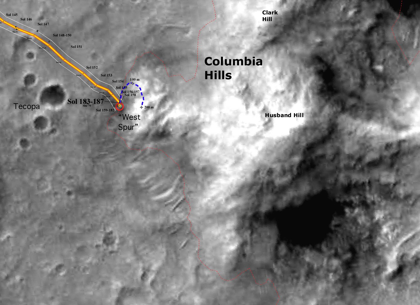
In figure 2, the map illustrates the NASA Mars Exploration Rover Spirit's
position at the base of the "Columbia Hills" from sols 183 to 187 (July 9 to
13, 2004). The dotted blue line indicates the rover's planned energy-efficient
path to climb the hill and reach the intriguing rock outcrops at the top of
"West Spur."
The maps were created using data from the camera on NASA's Mars Global
Surveyor orbiter.
Image credit for figures 1 and 2: NASA/JPL/MSSS/ASU/New Mexico
Museum of Natural History and Science
