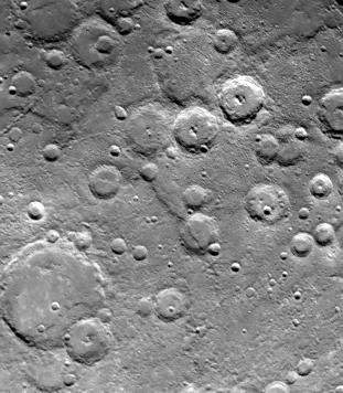
One of Mariner 10's two TV cameras took this picture (FDS 166614) of a densely cratered region of Mercury at 12:39 p.m. PDT, September 21, 1974, 80 minutes prior to the spacecraft's second close encounter with the planet. Taken from a range of about 76,000 kilometers (47,000 miles) the picture shows a scarp, or cliff, two kilometers (7500 feet) above the surrounding area and is part of a larger system of faults which extends for hundreds of kilometers. Mariner 10, which mapped about one-quarter of Mercury's surface last March, is the first spacecraft to return to its target planet.
The Mariner 10 mission, managed by the Jet Propulsion Laboratory for NASA's Office of Space Science, explored Venus in February 1974 on the way to three encounters with Mercury-in March and September 1974 and in March 1975. The spacecraft took more than 7,000 photos of Mercury, Venus, the Earth and the Moon.